The recent earthquakes in Turkey once again propelled the dynamic nature of Earth into the media spotlight, and highlighted the devastation that active faults can have on populations. A smaller earthquake in South Wales last week bought this awareness closer to home, especially given that the tremor occurred in the night while most people were inside and in bed.
Geologists and geophysicists are quick to point out that the earth is literally riddled with active, inactive and dormant faults. The major earthquake in Turkey occurred in a highly active fault zone formed at a junction between two large landmasses that are effectively sliding past one another. The much smaller tremor in Wales was more typical of the type and size of earthquake that we experience several times a year across the UK. It was still strong enough to cause buildings to shake and contents to fall off shelves.
As ground investigators the teams at GRM frequently identify known faults and fault lines as part of our in initial studies for landowners and developers. Displacement on these is often minimal and further noticeable fault movement within the lifetime of a housing development is highly unlikely.
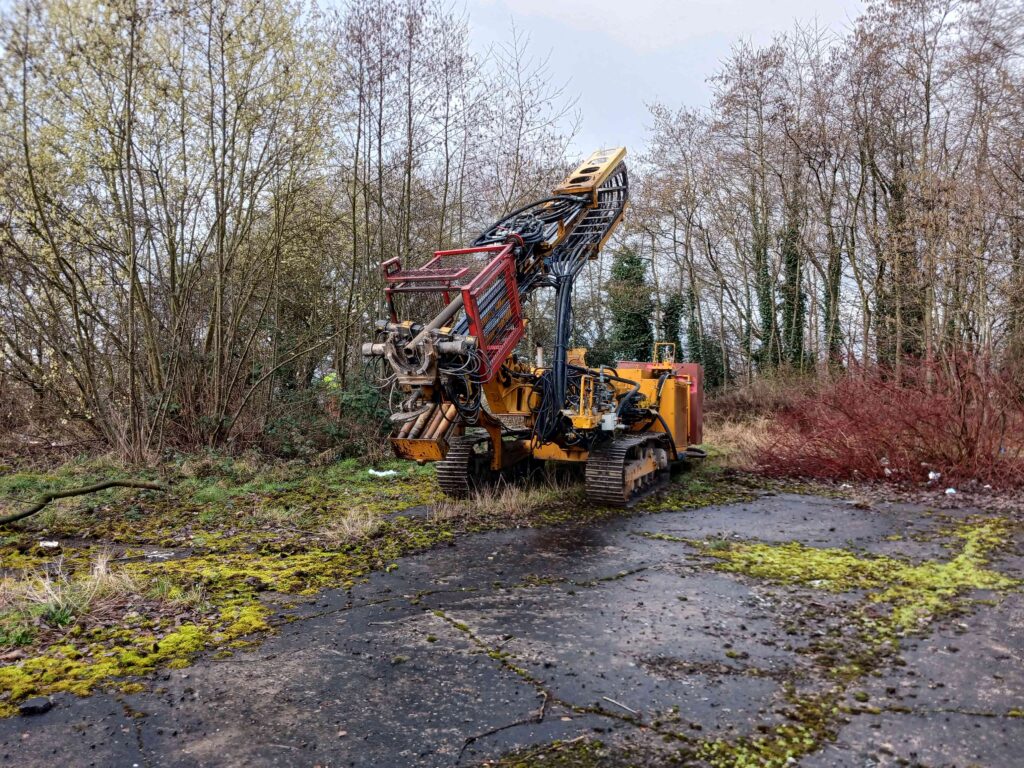
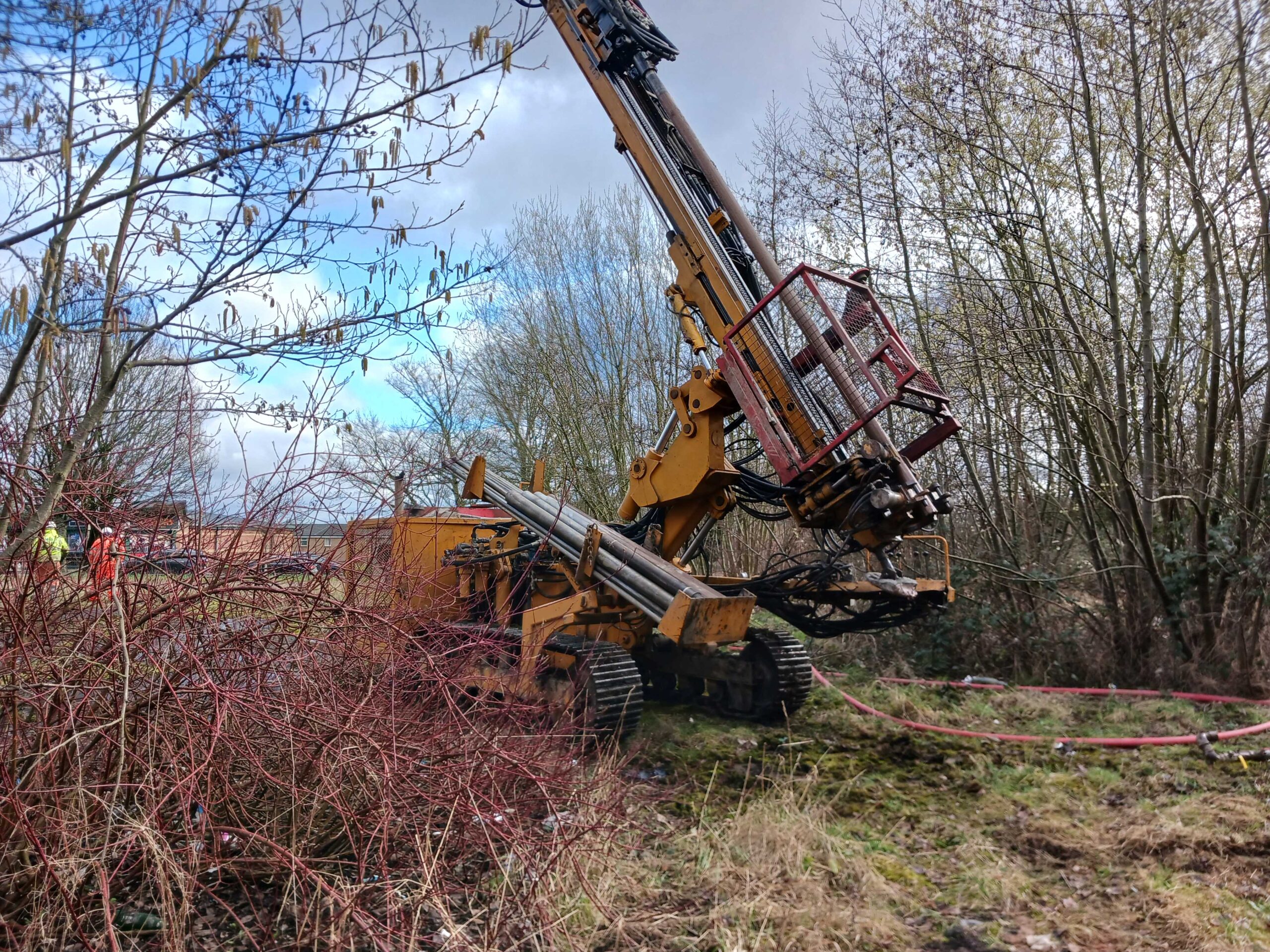
In some cases we discover previously unknown faults and fault zones during subsequent site investigations. A recent example of this came to light during site investigations of some land in NW England. The potential development site is located in an area known for historic coal mining. Our site investigations were therefore focused on locating unrecorded mine workings at depths of around 20m.
Three rotary probe boreholes were taken to investigate the presence of any shallow coal seams, remnant coal mine workings and to confirm the thickness of overlying rock. The boreholes identified c. 16m of superficial Glaciofluvial Deposits overlying Pennine Middle Coal Measures of sandstone and mudstone.
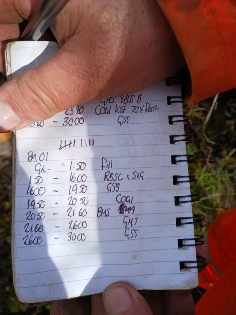
A coal seam was located at 19.50m in one exploratory hole and thick sandstone in the second exploratory hole. The third borehole between the first two resulted in a loss of flush and soft drilling. One explanation for this would be the occurrence of a fault zone in the third hole, which would account for the disturbed and softer sub-surface material. The area around the site is heavily faulted and we believed the fault to the west of the site (normal fault), against which the coal seam identified in the one exploratory hole terminates is actually present on site. Further work is taking place which will allow the developer to fully understand the nature of the subsurface ahead of construction.
GRM have a wealth of experience and expertise especially in areas prone to historic coal mining. We have an outstanding track record helping owners and developers understand their land and undertake the necessary investigations to support developments. If you have any development or construction projects, then please get in touch to find out how we can help save both time and costs. Please use your main point of contact at GRM or for new enquiries email richard.upton@grm-uk.com or call 01283 551249.